Multimedia Content
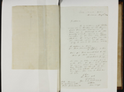
Letter to Council from M Howe, 6 May 1844, courtesy of Public Record Office Victoria, Victorian Archives Centre.
Details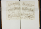
Letter to Public Works Committee from J Sutherland, courtesy of Public Record Office Victoria, Victorian Archives Centre.
Details
Letter to Public Works Committee from John Bennet, courtesy of Public Record Office Victoria, Victorian Archives Centre.
Details
Letter to Public Works Committee from John Pagan, 4 September 1843, courtesy of Public Record Office Victoria, Victorian Archives Centre.
Details
Letter to Public Works Committee from Lonsdale Hillier, 3 June 1844, courtesy of Public Record Office Victoria, Victorian Archives Centre.
Details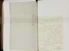
Letter to Public Works committee from M Howe, 31 July 1843, courtesy of Public Record Office Victoria, Victorian Archives Centre.
Details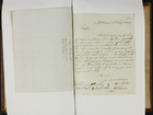
Letter to Public Works Committee from Robert Lumsden, 11 July 1844, courtesy of Public Record Office Victoria, Victorian Archives Centre.
Details
Letter to the Public Works Committee from J Benn, 16 September 1844, courtesy of Public Record Office Victoria, Victorian Archives Centre.
Details
Letter to Town Clerk from Edward Ewell, 18 September 1844, courtesy of Public Record Office Victoria, Victorian Archives Centre.
Details
Letter to Town Clerk from Robert Lumsden , 11 September 1843, courtesy of Public Record Office Victoria, Victorian Archives Centre.
Details
Floods and Drainage
Before the establishment of Melbourne, rain falling on the area drained into a system of creeks that ran into the Yarra or the Maribyrnong rivers and thence into Port Phillip Bay. Land in Central Melbourne sloped down to the Yarra and was reasonably well drained, but other areas that have subsequently been built on, such as parts of Port Melbourne, South Melbourne, West Melbourne and Kensington were low lying and flat, and therefore naturally swampy.
In Melbourne's early years, the natural drainage network struggled to cope with the demands of the city. Roads, house roofs and other impervious surfaces prevented rainfall from sinking into the soil and increased the amount and velocity of run-off. Eventually municipalities built their own drains, but as these were not part of a co-ordinated metropolitan-wide system, they were of limited use, especially in low-lying areas. This situation improved from 1924, when the Melbourne and Metropolitan Board of Works, and subsequently Melbourne Water, were given responsibility for managing the network of main drains, the Yarra, the Maribyrnong and the creeks that run into them.
Victoria's variable rainfall means that the level of the Yarra River and its tributaries can vary enormously. Because building had been allowed on land that was liable to inundation, floods were inevitable and houses in low-lying suburbs were periodically flooded. The first major Yarra flood occurred at the end of 1839. When measured in terms of peak water flows, the great flood of 1863 was probably the largest since the beginning of European settlement, but those of 1891 and 1934 were almost as large and caused massive damage. After each inundation there were inquiries, resulting in flood-relief works designed to lessen the prospect of future flooding. As a result, by the mid-20th century the Yarra had been widened, deepened and straightened along most of its urban reaches, as well as downstream into Port Phillip Bay, to become unrecognisable from the natural small, meandering stream of 1834. The Maribyrnong too was much modified in parts. The basic philosophy underlying this work was to get floodwater into the bay as quickly as possible by minimising obstructions to its flow.
As suburbs spread outwards in the second half of the 20th century, city planners were increasingly successful in preventing building in flood-prone areas. This allowed a change in drainage philosophy. Flood plains could now be allowed to hold waters for some time, thus reducing flood levels further downstream. Some 140 flood-retarding basins have been constructed throughout the metropolitan area, usually doubling as playing fields, parks or wetlands when not required to hold back floodwaters.
There have been fewer major floods in Melbourne in recent years. This is partly a consequence of increasingly effective early warning and preventative measures, but it would be a mistake to assume that the city is no longer flood prone. Sudden intense storms continue to overload the drains and to flood houses, roads, workplaces and shops not normally susceptible to inundation.