Multimedia Content
Letter to Council from M Howe, 10 July 1843, courtesy of Public Record Office Victoria, Victorian Archives Centre.
Details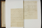
Letter to Mayor from M Howe, 6 January 1843, courtesy of Public Record Office Victoria, Victorian Archives Centre.
Details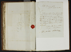
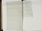
Letter to the Public Works Committee from J Sutherland, 19 September 1844, courtesy of Public Record Office Victoria, Victorian Archives Centre.
Details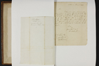
Letter to Town Clerk from M Howe, 2 January 1843, courtesy of Public Record Office Victoria, Victorian Archives Centre.
Details
Letter to Town Surveyor from J H Murphy, 15 January 1844, courtesy of Public Record Office Victoria, Victorian Archives Centre.
Details
Surveying
In late 1836 Governor Bourke sent three surveyors, Robert Russell, Frederick D'Arcy and William Darke, together with 36 convicts, to the Port Phillip District with instructions to chart the shore of Port Phillip Bay and plot the course of the Yarra River. Russell, who was in charge of the party, chose, however, to prepare a topographical map of the area adjacent to the Yarra River to the west and east of Batmans Hill, on which he plotted the locations of the existing squatters' dwellings. Although Russell claimed that the horses would require conditioning before they would be fit for the larger survey, Bourke was not impressed, and when he visited the settlement in February 1837 he arranged for his companion, Robert Hoddle, to take charge of the survey party. Hoddle lost no time in completing the required tasks and on 24 March 1837 forwarded to Bourke a proposed layout of the future Town of Melbourne, plotted onto Russell's plan of the settlement. A grid pattern with the major streets practically parallel to the Yarra River, Hoddle's layout conformed in design with the regulations Governor Darling had laid down after an inquiry in 1829.
For a short period in 1840-41, special surveys were allowed that left the internal subdivision of 8-square-mile (5120-acre, 2048 ha) parcels to landowners. Three people who used the scheme in metropolitan Melbourne were Henry Dendy (Brighton), Henry Elgar (Box Hill and Balwyn) and Frederic Unwin (Templestowe and Bulleen). When the new colony of Victoria was created on 1 July 1851, Hoddle became its first surveyor general, a position that the head of the surveying profession retains to this day. His foresight in setting aside large tracts of Crown land for parks and gardens, schools, churches, a cemetery, public buildings and wide access approaches from the south (St Kilda Road) and the north (Royal Parade) enabled the city to develop.
Surveying is linked intrinsically to Acts passed by the Victorian Parliament that relate to land and land law. Under the supervision of the Department of (Crown) Lands and Survey, vast tracts of Crown land were opened up for selection. The Sale of Crown Lands Act 1860, the Sale and Occupation of Crown Lands Act 1862, the Land Acts of 1869 and 1884, the Property Law Act 1928 and the Transfer of Land Statutes and Acts of 1862, 1866, 1885, 1890, 1915 and 1928 all placed huge demands on surveyors. The 'Torrens system' of title registration, whereby persons acquiring land from the Crown after 1862 received a clear title to the land and with it the means of simplifying the procedure to transfer the land, was introduced following the passing of the Real Property Act 1862. The Land Surveyors Act 1895 gave power to the Surveyors Board to register and licence surveyors whom they considered suitable to practise in Victoria.
Growing problems of water supply and sanitation led planners to commission a detailed survey. Between 1891 and 1895, an extremely accurate standard traverse was made around Melbourne streets and approximately 1500 cast-iron marks laid down. Contracting surveyors were engaged to prepare detailed plans of the city blocks. Levels were obtained for all streets and lanes; Crown land and titles office and railway information was recorded, as was the location of drains, gas and sewer mains. When the project was completed, 1465 detailed plans, drawn at a scale of 40 ft to an inch (1:480) had been prepared for Melbourne and the inner suburbs.
Melburnians are fortunate that in 1940 the Victorian Government, on the advice of the surveying profession, passed the Survey Co-ordination Act. This Act, inter alia, referred to the establishment of permanent survey marks and their compulsory connection of surveys. Apart from the marks of the standard traverse, an abundance have subsequently been placed in and around the city. Melburnians are therefore well prepared for advances in surveying techniques, especially with regard to the future use of computers and satellites. The Survey Co-ordination Act also legislated for the formation of the Central Plan Office, which holds a wide range of survey documents from the maps of foundation and early settlement through to the acquisition plans of the CityLink project. The passing of the Surveying Act 2004 enhanced previous legislation and included improved protection for the consumer.
- References
- Cannon, Michael, and Ian MacFarlane (eds), Surveyor's problems and achievements, 1836-1839, Victorian Government Printing Office, Melbourne, 1988. Details
- Cannon, Michael, and Ian MacFarlane (eds), The Crown, the land and the squatter, 1835-1840, Melbourne University Press, Melbourne, 1991. Details
- Chappel, Surveying for land settlement in Victoria 1836-1960, Office of Surveyor General, Melbourne, 1996. Details
- Scurfield, J.M., The Hoddle years: surveying in Victoria, 1836-1853, Institution of Surveyors, Australia, Canberra, 1995. Details